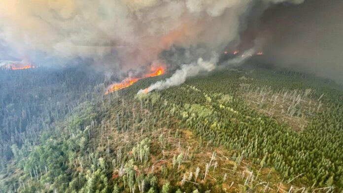
It remains all hands on deck for crews battling the Donnie Creek Wildfire, southeast of Fort Nelson.
The second-largest blaze in BC’s history is over 389-thousand hectares in size.
Fire Information Officer, Julia Caranci told Vista Radio smoke will continue to remain visible from Highway 97 but the road does not look to be comprised at this point.
“At this time there is no indication that it will reach the highway within the next 48 hours and that is our current information at this time.”
“Smoke from the complex is going to be highly visible from the Alaska Highway and during clear periods columns of smoke are very likely to be visible as well. However, at this time, the fire is not impeding traffic on the highway.”
Significant growth has occurred over the past two days on the northeast and west flanks, which has comprised some mitigation efforts.
She adds crews have begun working on containment lines on portions of the south and west flanks of the fire.
An area restriction order for the Donnie Creek Complex was issued yesterday (Thursday).
“We’ve done that to protect the public in areas where there are ongoing fire suppression activities and where there are active dangerous fires.”
“We are facilitating entry by critical needs for industry and we are facilitating that through BC Wildfire here,” added Caranci.
167 fire personnel along with 12 helicopters and 27 pieces of heavy equipment are battling the blaze.
The volatile wildfire situation in the Peace Region has led to a series of Evacuation Orders, including Tumbler Ridge, which occurred yesterday (Thursday).
(With files from Brendan Pawliw-MyPGNow)
Something going on in the Cariboo you think people should know about?
Send us a news tip by emailing [email protected].


