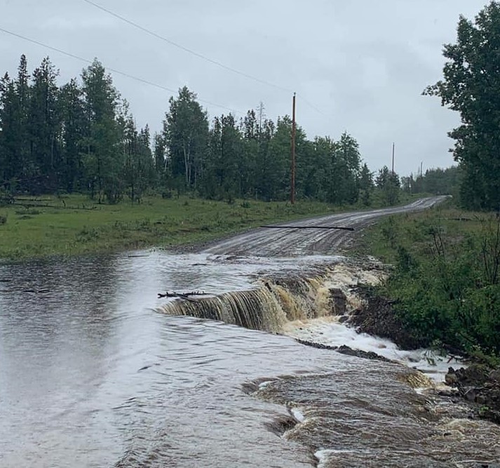
The Cariboo Regional District (CRD) is currently assessing road conditions in the West Chilcotin due to flooding.
A flood watch issued Sunday for the Chilcotin River and its tributaries was upgraded Monday to a warning.
“Our monitoring indicated that the river would crest, so it reaches its highest peak today and our continued monitoring indicates that’s the case,” said hydrologist with the River Forecast Centre, Ashlee Jollymore.
“Currently our modeling was updated this morning and it indicates that the river would peak today and then it would slowly recede throughout this week.”
The Cariboo Regional District that activated its Emergency Operations Centre (EOC) on Monday said some areas in the West Chilcotin, including the Big Creek and Nemiah Valley areas, are currently experiencing high stream flows and flooding.
Some roads in the areas are washed out including Witte Road (Farwell Canyon Road) and the Gaspard Creek – Mons Creek Forest Service Road.
“Our main focus today is to work on mapping so that we have a good understanding of which properties along those river tributaries would be affected depending on water levels,” said Emily Epp, EOC public information officer.
Epps added it is not clear at this time how many people are impacted.
“It definitely covers a very big area in the West Chilcotin,” she said.
“We’ve so far chatted with about 15 or so people. We know there’s more people who haven’t reached out to us yet which is why we’re encouraging people to contact us and then as we chat with them we are able to determine what their needs are in terms of potable water or food because for the most part if it’s safe to do so we’re encouraging people to shelter in place if they have the resources to do so.”
Something going on in the Cariboo you think people should know about?
Send us a news tip by emailing [email protected].


