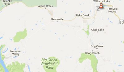
Traffic can now travel eastbound and westbound along the entirety of Highway 20.
The Cariboo Regional District adjusted evacuation orders by creating evacuation alert zones along Highway 20 stretching five kilometres north and south of the highway.
Residents who live in this corridor can return home but remain on evacuation alert.
The CRD says anyone returning must continue to be prepared to evacuate their premises or property should an evacuation be required.
Other than along the Highway 20 corridor, evacuation order areas remain unchanged in the Chilcotin.
- In conjunction with the opening of Highway 20, Tl’esqox (Toosey) is downgrading evacuation orders for their community to evacuation alerts through the jurisdiction of their Chief and council. Please contact their local First Nation government directly.
- Tl’etinqox (Anaham) community self-evacuated, although Chief and council never issued an order or alert. Please contact their local First Nation government directly.
- Yunesit’in (Stone) remains on evacuation order as per Chief and council. For more information, please contact their local First Nation government directly.
To see current maps reflecting these changes, visit cariboord.ca. A searchable digital map is also available at arcg.is/2uGik7U. The map now includes fire perimeter data as well.
“Wildfire activity continues in the Chilcotin and conditions are monitored daily. Residents are encouraged to follow www.drivebc.ca for up to date road information,” the CRD states.
Something going on in the Cariboo you think people should know about?
Send us a news tip by emailing [email protected].


